
FS-2002-12-049-GSFC
Are the ice sheets that still blanket the Earth’s poles growing or shrinking? Will global sea level rise or fall? NASA’s Earth Science Enterprise (ESE) has developed the ICESat mission to provide answers to these and other questions to help fulfill NASA’s mission to understand and protect our home planet. The primary goal of ICESat is to quantify ice sheet mass balance and understand how changes in the Earth’s atmosphere and climate affect polar ice masses and global sea level. ICESat will also measure the distribution of clouds and aerosols, as well as land topography, sea ice, and vegetation cover.
Ice sheets are complex and dynamic elements of our climate system. Their evolution has strongly influenced sea level in the past and currently influences the global sea level rise that threatens our coasts. Ice streams that speed up, slow down, and change course illustrate their dynamic nature. Atmospheric factors cause snowfall to vary in space and time across their surfaces. In Antarctica, small ice shelves continue to retreat along the Antarctic Peninsula, and large icebergs are released from its largest ice shelves. In Greenland, the ice margins appear to be thinning and the inland parts of the ice sheet may be thickening. Surface melt water seep into the ice sheets and accelerates their flow. Some of the factors controlling the mass balance of ice sheets, and their present and future influences on sea level, are just beginning to be understood.
The ICESat mission, part of NASA’s Earth Observing System (EOS), is scheduled for launch in December 2002. The Geoscience Laser Altimeter System (GLAS) on ICESat will measure ice sheet elevations, changes in elevation through time, height profiles of clouds and aerosols, land elevations and vegetation cover, and approximate sea ice thickness. Future ICESat missions will extend and improve assessments from the first mission, as well as monitor ongoing changes. Together with other aspects of NASA’s ESE and current and planned EOS satellites, ICESat will enable scientists to study the Earth’s climate and, ultimately, predict how ice sheets and sea level will respond to future climate change.
The Geoscience Laser Altimeter System (GLAS) is a next-generation space lidar. It is the sole scientific instrument on ICESat. GLAS combines a precision surface lidar with a sensitive dual wavelength cloud and aerosol lidar. GLAS has 3 lasers that emit infrared and visible laser pulses at 1064 and 532 nm wavelengths. These lasers operate at eye-safe signal levels but only one will operate at any given time.
On orbit, GLAS continuously emits laser pulses at a rate of 40 per second from the Earth-facing (nadir) side of ICESat. GLAS measures precisely how long it takes for photons in a laser pulse to pass through the atmosphere to the Earth, reflect, and travel back to GLAS. Halving the total travel time, and applying corrections for the speed of light through the atmosphere, the distance from ICESat to the laser footprint on Earth can be calculated. ICESat will collect data for calculating its position in space by using on-board GPS (Global Positioning System) receivers augmented by a network of ground GPS receivers and satellite laser ranging stations. The angle of the laser beam relative to stars is measured precisely by GLAS with star-tracking
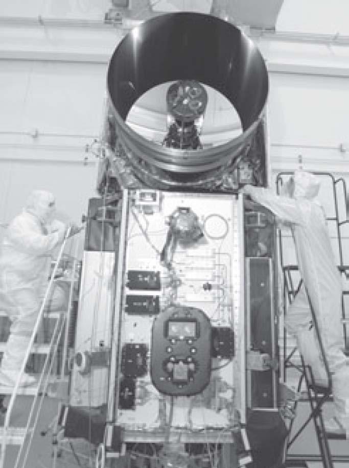
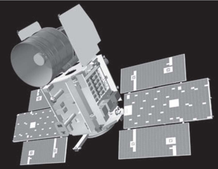
The Geoscience Laser Altimeter System (GLAS) on the Ice, Cloud, and land Elevation Satellite (ICESat) spacecraft. The solar arrays have not yet been attached. Cameras on the zenith side of ICESat.
The data on the distance to the laser footprint on the surface, the position of the satellite in space, and the pointing of the laser beam are all combined to calculate the elevation and position of each point measurement on the Earth below.
As ICESat orbits, GLAS takes data along ground tracks defined by the sequence of laser spots. GLAS produces a series of approximately 70 m (230 ft) diameter spots that are separated by nearly 170 m (560 ft) along track. These ground tracks will be repeated every 8 days during the commissioning phase of the mission and then every 183 days during the main portion of ICESat’s multi-year mission. ICESat will also provide detailed information on the vertical distribution of clouds and aerosols illuminated by its laser spots. To do this, GLAS also emits laser energy at 532 nm and its receiver has sensitive photon counting detectors. Together with information from the 1064 nm channel, these provide atmospheric backscatter profiles that are spatially co-located with the surface height measurements. In addition to their value for atmospheric studies, the atmospheric measurements will aid in determining the influence of any aerosol scattering on the surface height estimates.
The GLAS instrument was developed at NASA Goddard Space Flight Center in partnership with a science team from universities, government, and industry. Ball Aerospace built the spacecraft and ICESat will be launched on a Boeing Delta II rocket. Once on-orbit ICESat will be operated by the University of Colorado, Laboratory for Atmospheric and Space Physics. The GLAS and ICESat data will be initially processed at the ICESat Science Investigator-led Processing System with support from the University of Texas, Center for Space Research. The mission data will be distributed and archived by the National Snow and Ice Data Center. ICESat is designed to operate for 3 to 5 years and will be followed by successive missions to measure ice sheet elevations and other Earth phenomena over the next 15 years.
For additional information on this NASA mission, go to the ICESAT Web Site